
By default, QTH.app uses the built-in Location Services on macOS to determine your location in order to beacon your position to the APRS network. While this is more convenient than having to manually enter your location, it has some drawbacks.
Your approximate location is determined using information from local Wi-Fi networks, and is collected by Location Services in a manner that doesn’t personally identify you.
I confess, the manner in which it truly works is still a mystery to me. But, what is clear is that:
- Location Services on macOS uses WiFi to determine your location
- The MacBook laptops, while portable, do not contain GPS receiver hardware inside them, like an iPhone does
When added up, it’s clear that if you are traveling down the road in a vehicle, Location Services is not going to give you accurate position information. For that, you really need a GPS device.
Ok, but what if you don’t have a GPS?
Do you have an iPhone?
If you have an iPhone, you have a GPS device. The tricky part is getting the data from the iPhone to the MacBook, where QTH.app can make use of it. Fortunately, as they say, ‘there’s an app for that’.
The app in question, is GPS2IP from Capsicum Dreams.

You will likely want to purchase the full edition, because the free edition is time limited, but the free edition can be used to try it out.
To use this app with QTH.app, here are the steps:
- Open GPS2IP and tap Settings
- Under ‘Network Selection’, choose ‘Bluetooth’
- Tap ‘Done’
- Back on the main screen, use the toggle switch to turn GPS2IP on
- In QTH.app, add a new “Bluetooth LE GPS” connection.
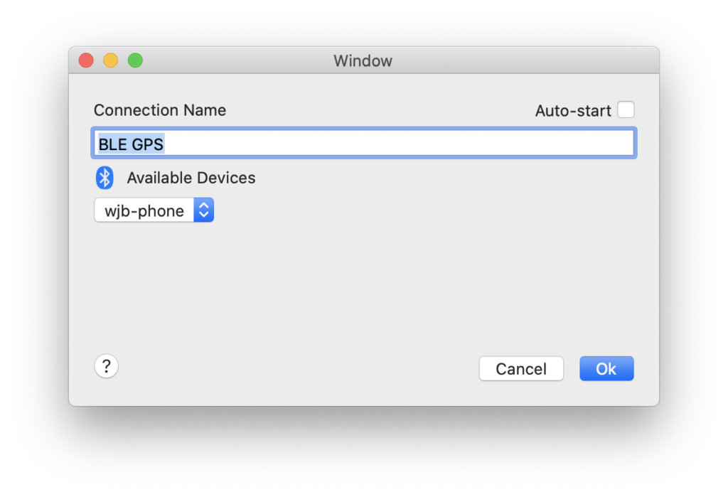
- When GPS2IP is running, you should see the name of your iPhone appear in the drop down list. Choose it.
- Click Ok
- Start the connection
QTH.app will begin receiving location updates from you phone just as if you had connected a serial GPS device!
Every cellular device that is equipped with GPS and WiFi antenna is providing this catalog of WiFi geofencing to big tech (for lack of a better term). Google Streetview camera cars are equipped with WiFi sniffing capability also to catalog the location of networks. Uber, Lyft–probably other services like DoorDash–are collecting this information through their service-provider apps. Don’t forget shadow networks that are constant-on from certain home telecom providers. This perpetual effort using reverse geo-fencing technique and radio triangulation has proven very useful. While certainly beneficial, it gives me moment for pause.